We have 8 guests online

Search Tracks by Town or North/Centre/South

RSS
You can start the track in the village or a couple of km further, close to the dried river bed (Barranco). You follow this barranco till the end to reach the sea for a refreshing moment. But do not swim out, as there are strong currents!
Approx. distance: 9 km, approx. elevation: 178 m
Hits 1276

See full Track Info


A nice walk along the cliffs and sandy beaches on the West side of Fuerteventura. Also achievable in the summer for adults when regular "cooling" periods in the sea are respected. An extended family walk in the winter.

Approx. distance: 5 km, approx. elevation: 33 m
Hits 1799

See full Track Info


The track starts in the village and goes west in a dries river bed (Barranco) to end up in a parking lot, next to the museum about the ancient village "Atalayita". You can visit the ruins of this village and walk up the small nearby volcano. The way back is mainly in a wide barranco.

Approx. distance: 8,4 km, approx. elevation: 63 m
Hits 995

See full Track Info


You can start your walk from the village or from the beach towards the tiny island "el islote" and end up North till the cliffs and the sea come together. Amazing views over the steep mountains and the impressive waves. STRONG CURRENTS - DO NOT SWIM OUT!

Approx. distance: 7,7 km, approx. elevation: 66 m
Hits 1469

See full Track Info

 
An impressive walking track for the entire family, although children must be kept at hand at all times: steep cliffs! The proximity of the massive and bare rocks creates a sense of futility. Jean de Bethencourt and his crew came along here about 600 years ago when conquering the island.
Approx. distance: 1 km, approx. elevation: 75 m
Hits 1653

See full Track Info

 
The track is running through one of the most impressive landscapes of the island. The impressive rocks, the tiny chapel of the patron saint of Fuerteventura and the small path will give you a very special sensation.
Approx: Distance: 3,57 km – Approx. Elevation: -85 m
Hits 939

See full Track Info

 
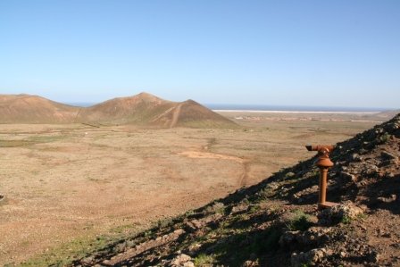
The track starts with a light slope towards a platform with nice views over Lajares, Villaverde and the distant dunes. The short climb (approx. 100m) to the summit of the volcano is somewhat heavy, especially when it is hot, but is also doable for kids over 12. From here you have a good view over the North Shore of Fuerteventura and over Lanzarote. The way back is light.
Approx. distance: 4,9 km / Approx. elevation: 128 m
Hits 839

See full Track Info

 
The track is running through the very southern part of Fuerteventura. You pass an old (1963) military airfield without buildings and go North to the shore to see the impressive erosion, the result of the brutal forces of the waves. You cross the island to the South again and return via some beaches.
Approx: Distance: 12,8 km – Approx. Elevation: 125 m
Hits 435

See full Track Info

 
You leave the road before arriving to Ajuy and follow the track till the Barranco de la Peña. Here you go left till the rocky beach. The "Rocky Gate" will welcome you for a refreshing rest.
Approx. distance: 3 km - Approx. elevation: 60 m
Hits 661

See full Track Info

 
The track follows the coast line and connects the two villages, passing several valleys and small beaches that offer a welcome refreshment.
Approx: Distance: 6,9 km – Approx. Elevation: 65 m
Hits 737

See full Track Info

The track starts in a dried river and goes up to a platform. Then you go East on a shoulder to reach the top. Tip: start very early in the morning so that you have reached the top when the sun rises: unforgettable moments!
Approx: Distance: 8,2 km – Approx. Elevation: 240 m
 

See full Track Info

Additionally to our General Conditions of Use, mentioned in the chapter "Terms & Conditions" of this website, following terms apply:

The Spirit of Fuerteventura Company SCP provides walking, hiking, trekking and mountain biking data for Fuerteventura to their best knowledge. These data are to be meant solely as background information about possibilities for local leisure. At any time, people who might be interested in using these data for their own purpose, should control the validity of these data regarding to - for instance, but not limited to - legal and safety matters, and level of difficulty. Also, any suggestions mentioned on this website - particularly suggestions about what to take with you on a walk that are mentioned in our "General Remarks" - are for information purposes only and should be checked at all times before using them and should be modified and/or adjusted according to personal needs and opinions.

The Spirit of Fuerteventura Company SCP does not claim to provide complete information about any topic that is treated on this website, nor can it accept any responsibility for any damages - direct or indirect - that might occur due to lack of data or by using the data that are mentioned on this website